
Regionales Ostschweiz - Ausflugsziele in der Schweiz
Unsere Schweiz hat wirklich schöne Ortschaften und Ausflugsziele, die es wert sind besucht zu werden.
Klicken Sie auf den Kanton um zu entsprechenden Ausflugtipps zu kommen.


Ausflugsziele in der Region
Allerlei aus der Region
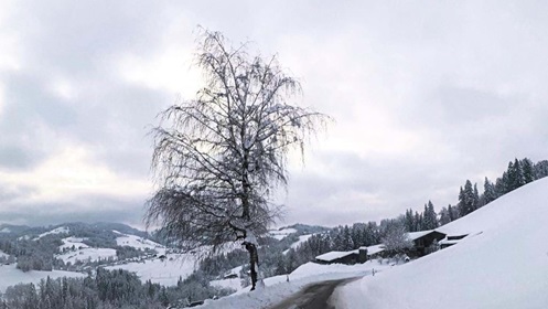
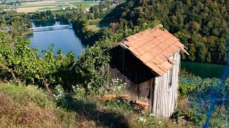
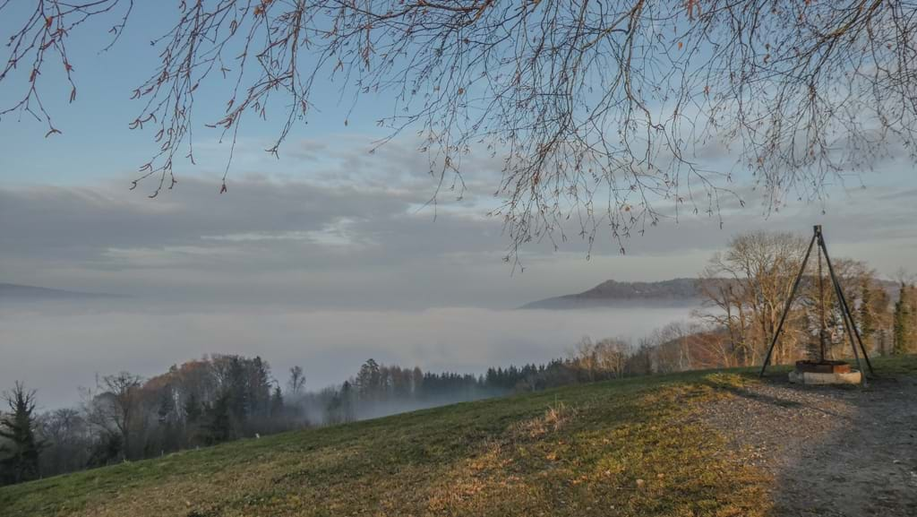
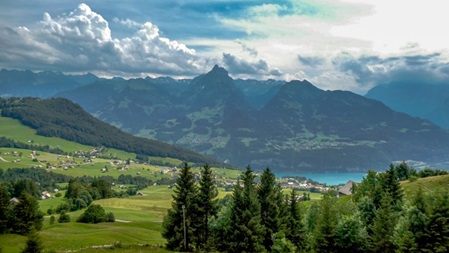
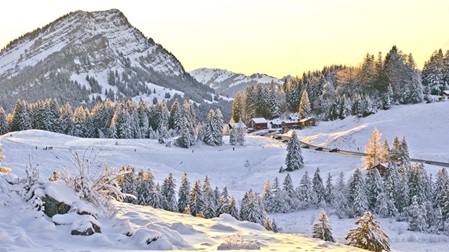
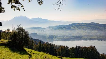
Schneefahrt durchs Toggenburg
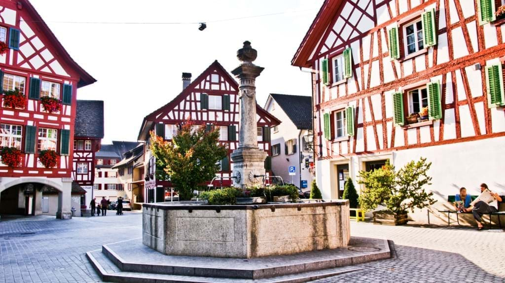
Ausflugsziele im Kanton Schaffhausen
Der Kanton Schaffhausen ist der nördlichste Kanton der Schweiz.
Mit Ausnahme eines kleinen Teils von Stein am Rhein (Vor der Brugg) und einem Fussweg von der Rheinbrücke von Schaffhausen nach Feuerthalen bis zum Wehr des Kraftwerkes Schaffhausen liegt der Kanton nördlich des Rheins, er ist fast ganz von der Bundesrepublik Deutschland umgeben und umgibt seinerseits die deutsche Exklave Büsingen am Hochrhein. Südlich grenzt der Kanton, hauptsächlich im Rhein, an die Kantone Zürich und Thurgau.
Der Kanton ist in drei Teilgebiete aufgeteilt. Das Kantonsgebiet bei Stein am Rhein wird als Oberer Kantonsteil bezeichnet, jenes bei Rüdlingen/Buchberg als Unterer Kantonsteil.
in English back
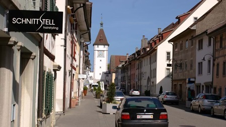
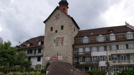
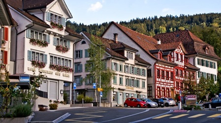
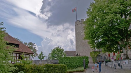
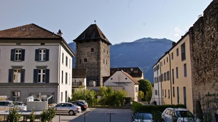
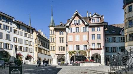
Schaffhausen
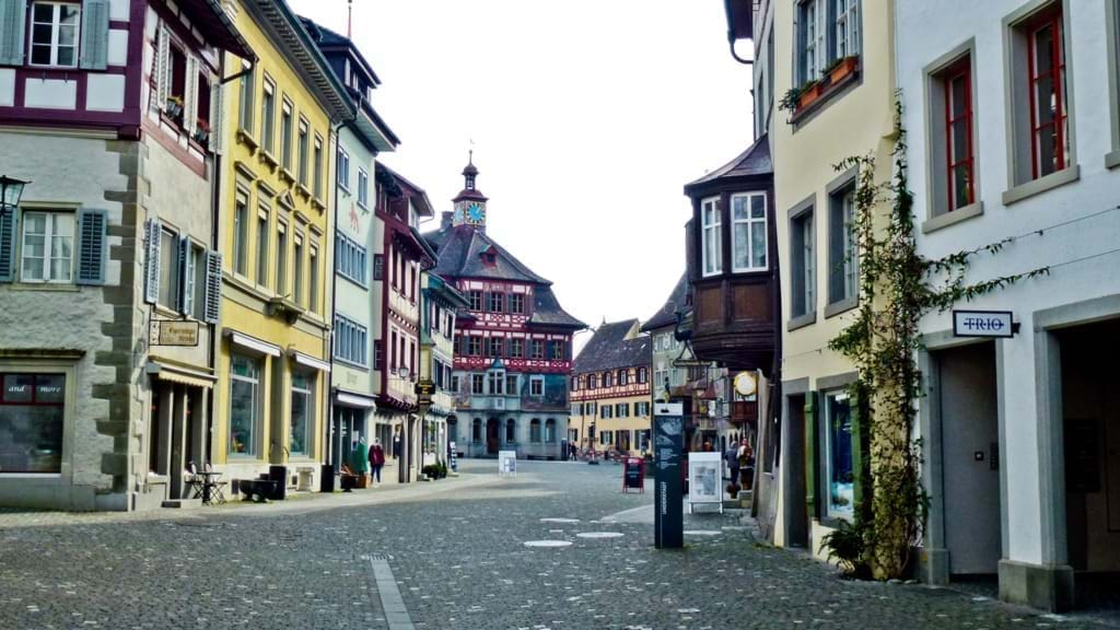
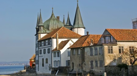
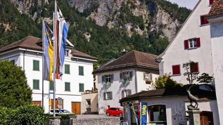
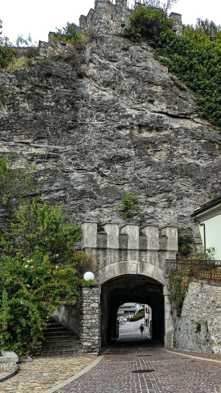
Stein am Rhein
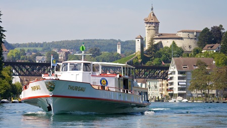
Schifffahrt auf
Untersee und Rhein
Hallau
Neunkirch
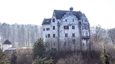
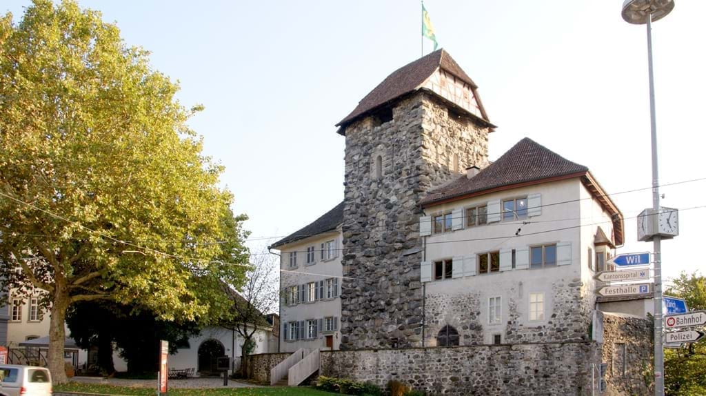
Rüdlingen / Buchberg
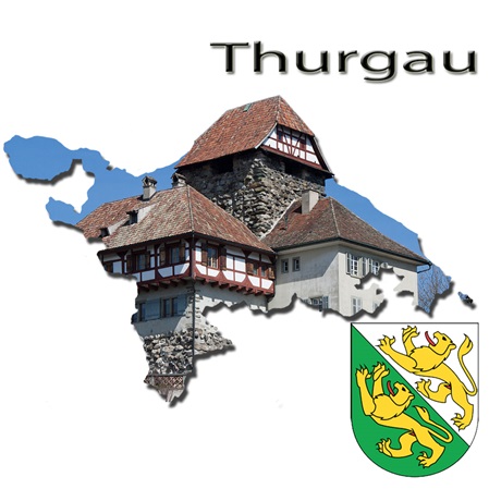
Ausflugsziele im Kanton Thurgau
Der Kanton Thurgau grenzt im Norden an das deutsche Land Baden-Württemberg und den Kanton Schaffhausen.
Im Süden ist in der Nähe des Hörnli der Grenzpunkt mit den Kantonen St. Gallen und Zürich. Unterhalb des Gipfels liegt in der Gemeinde Fischingen mit 991 Metern über dem Meeresspiegel der höchste Punkt des Kantons.
Der Hauptort und Sitz des Regierungsrates sowie des Obergerichts ist Frauenfeld. Der Kanton Thurgau hat seinen Namen vom Fluss Thur, der ihn von Südosten nach Nordwesten durchquert und weiter westlich im Zürcher Bezirk Andelfingen in den Rhein mündet.
in English back
Spirit-Parcours Aadorf

Naturena Sinnespfad Kalchrain
Sädelegg Fischingen
Bischofszell
Weinfelden
Steckborn
Salenstein
Napoleonturm Hohenrain
Frauenfeld
Hochwacht, Klingenzell
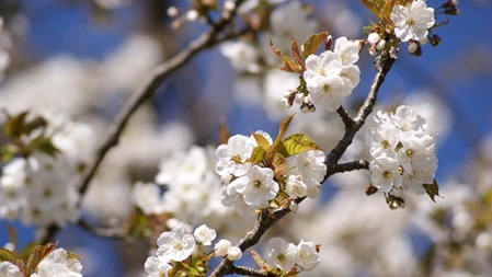
Frühlingsblüte
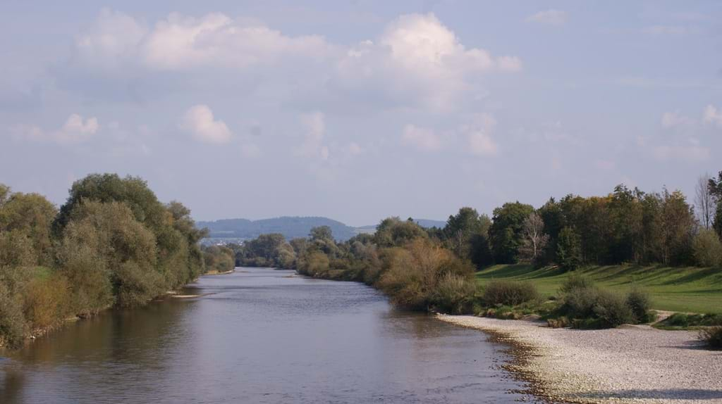
Thurlandschaft- und Auengebiet Schäffäuli
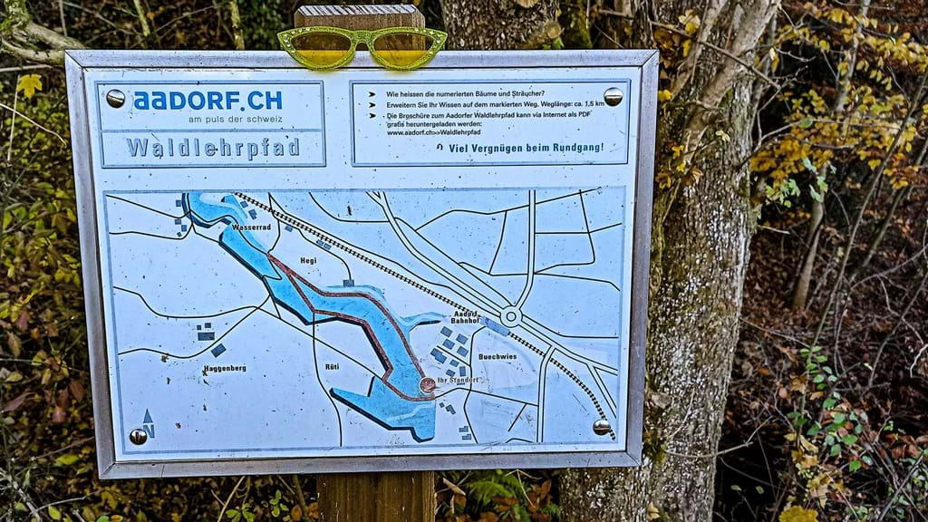
Waldlehrpfad Aadorf
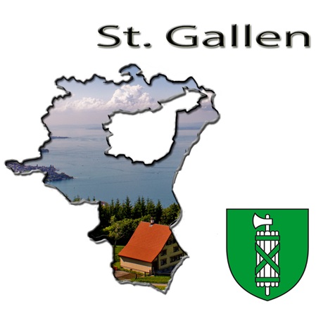
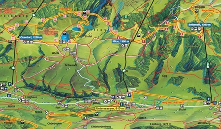
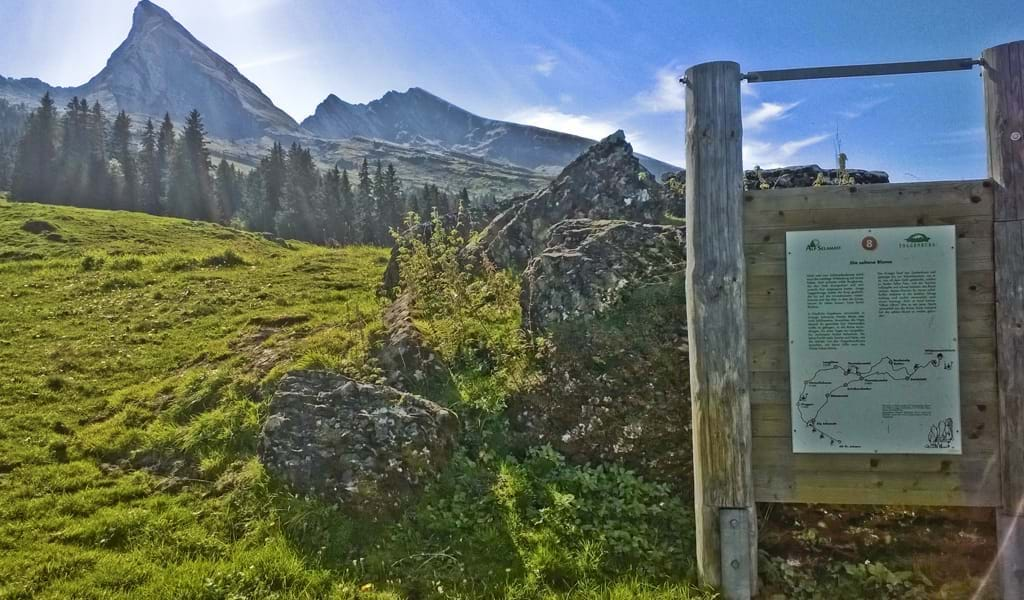
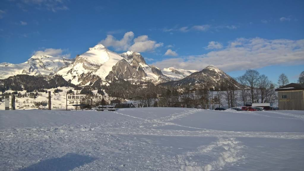
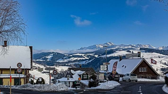
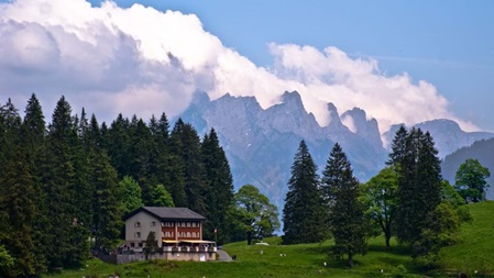
Ausflugsziele im Kanton Sankt Gallen
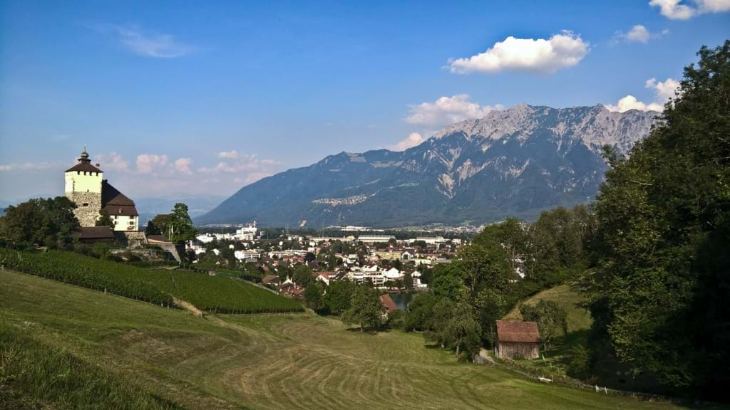
Der Ostschweizer Kanton St. Gallen grenzt an die schweizerischen Kantone Graubünden, Glarus, Schwyz, Zürich, Thurgau, im Norden an den Bodensee sowie im Osten an das österreichische Bundesland Vorarlberg und das Fürstentum Liechtenstein.
Durch den Bodensee grenzt der Schweizer Kanton indirekt an die Landkreise Konstanz, Bodenseekreis und Lindau in Deutschland. Ferner umschliesst er die Halbkantone Appenzell Innerrhoden und Appenzell Ausserrhoden.
in English back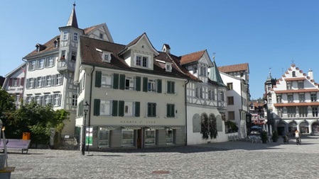
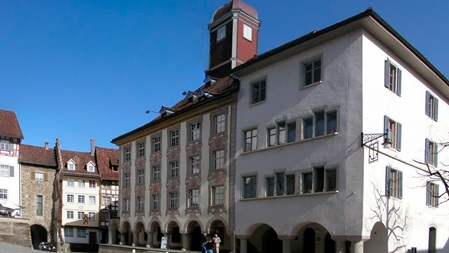
Stadt St. Gallen
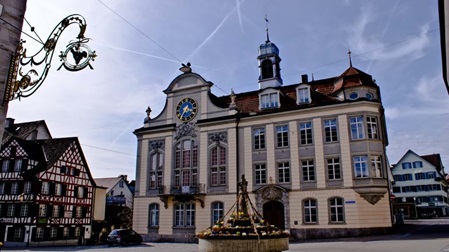
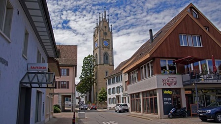
Stadt Wil
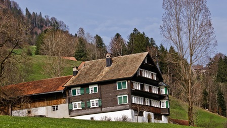
Das Nekertal
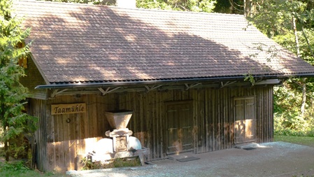
Taamühle Bütschwil
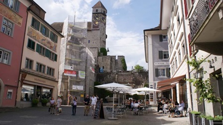
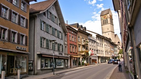
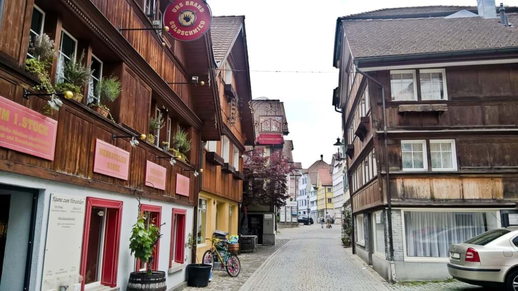
Lichtensteig
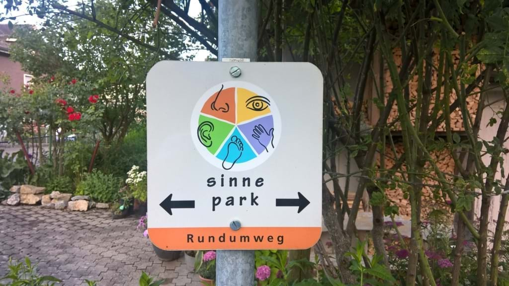
Sinnepark Ebnat-Kappel
Wolzenalp
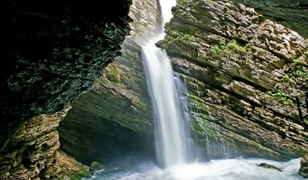
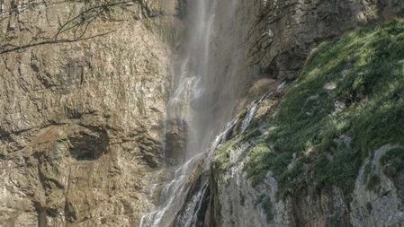
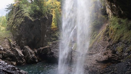
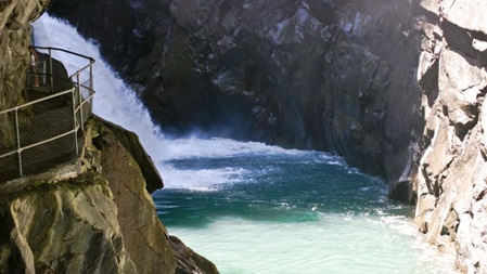
Thurwasserfälle
Klangweg Toggenburg
Sagenweg Toggenburg
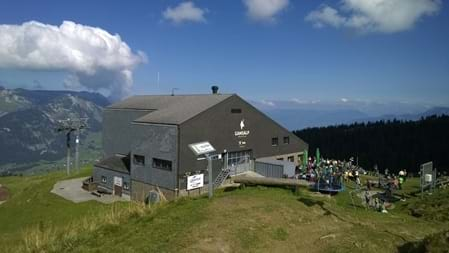
Chäserrugg
Schwendiseen
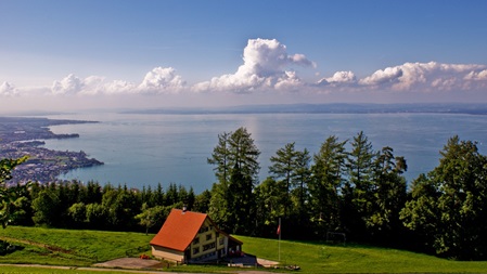
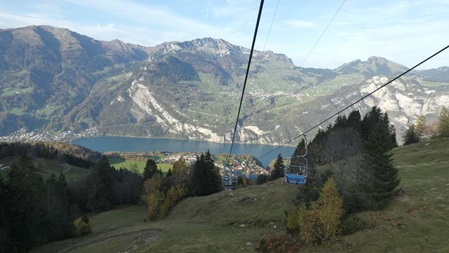
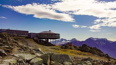
Fünfländerblick
Rapperswil
Werdenberg
Uznach
Amden Mattstockfuss
Seerenbachfälle Betlis
Murg
St. Iddaburg
Gamsalp
Hemberg
Pizol
Aussichtspunkt Chapf
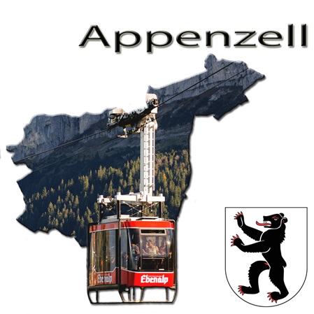
Ausflugsziele im Kanton Appenzell Innerrhoden und Appenzell Ausserrhoden.
Der Name Appenzell (lateinisch abbatis cella) bedeutet «Zelle (d. h. Gutsbesitz) des Abtes».
Dies bezieht sich auf die Fürstabtei St. Gallen, welche einen grossen Einfluss auf das Gebiet ausübte. Die konfessionellen Konflikte in der Gegenreformation führten dazu, dass sich der Kanton 1597 in das katholische Innerrhoden und das reformierte Ausserrhoden teilte.
"Kanton Appenzell" blieb als Sammelbegriff für beide Teile in Gebrauch, ist aber heute veraltet. Meist spricht man von «den beiden Appenzell» (politisch) oder vom «Appenzellerland» (geographisch), wenn man Inner- und Ausserrhoden gemeinsam meint.
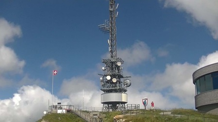
Höchster Berg ist der Säntis (2502 m ü. M.) im Alpstein, auf dem sich die Grenzen der drei Kantone Appenzell Innerrhoden, Appenzell Ausserrhoden und St. Gallen treffen.
in English back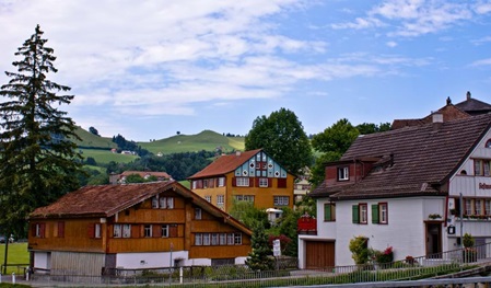
Appenzell
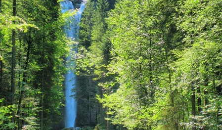
Leuenfall
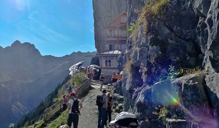
Ebenalp - Wildkirchli - Aescher
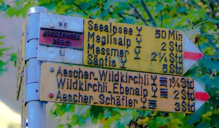
Seealpsee
Herisau
Hoher Kasten
Schwägalp
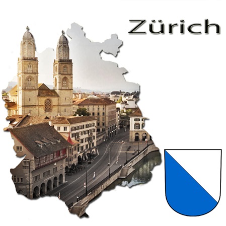
Ausflugsziele im Kanton Zürich
Der Kanton Zürich liegt grösstenteils im schweizerischen Mittelland.
Der äusserste Südosten des Kantons ist jedoch vor alpin geprägt, und der äusserste Nordwesten hat Anteil an den östlichsten Jura-Ausläufern. Der Kanton grenzt im Norden an den Kanton Schaffhausen und Deutschland (Grenze zwischen Deutschland und der Schweiz), im Westen an den Kanton Aargau, im Süden an die Kantone Zug und Schwyz, und im Osten an die Kantone Thurgau und St. Gallen. Östlich des Kantons Zürich beginnt die Ostschweiz.
Der Kanton Zürich wird in verschiedene kleinere Regionen aufgeteilt. Teilweise sind diese charakteristisch ländlich, doch die Verstädterung im Kanton Zürich ist weit fortgeschritten: Die Hauptstadt Zürich dominiert den Kanton.
Ganz im Norden des Kantons, zwischen Winterthur und Schaffhausen, liegt das Zürcher Weinland. Es ist sehr dünn besiedelt und hat wie keine andere Zürcher Region seinen ländlichen Charakter bewahrt. Südlich des Weinlands schliesst sich die Region Winterthur an. Winterthur ist die sechstgrösste Stadt der Schweiz und die zweitgrösste des Kantons.
Westlich der Region Winterthur bzw. nordöstlich der Stadt Zürich liegt das Zürcher Unterland. Dieses ist bereits Teil der Agglomeration Zürich, insbesondere das mittlere Glatttal ist stark verstädtert bzw. teilweise mit Zürich verwachsen, während das Furttal, das Wehntal und das Rafzerfeld jenseits des Rheins noch weitgehend ausserhalb der inneren Agglomeration liegen. Im Unterland liegt und dominiert zudem der Flughafen Zürich.
in English back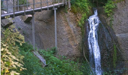
Farenbachtobel Elgg
Regensberg
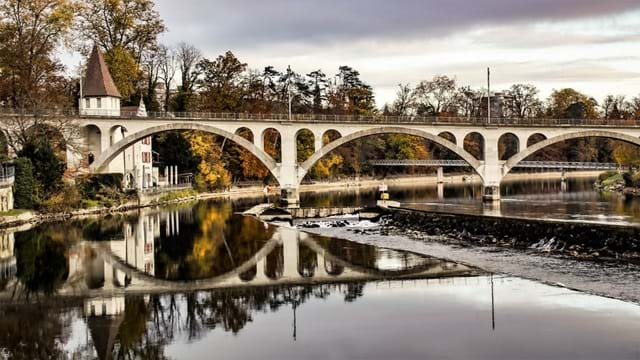
Andelfingen
Rheinau
Berg am Irchel
Bülach
Burgruine Schauenberg
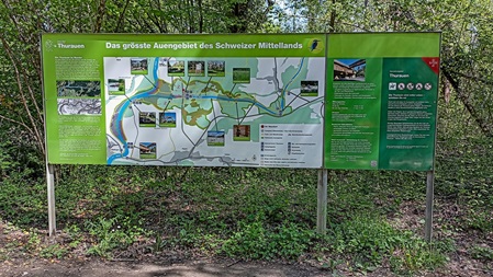
Thurauen
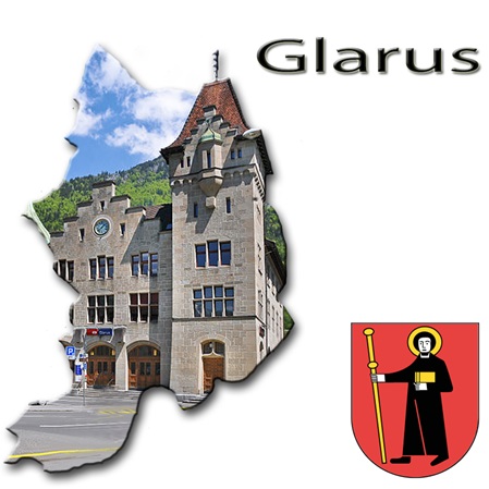
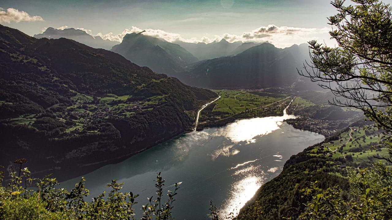
Ausflugsziele im Kanton Glarus
Der Kanton Glarus ist eines der steilsten Alpentäler.
Der Kanton umfasst das Einzugsgebiet der Linth bis zum Walensee und die Linthebene westlich der Linth bis Bilten sowie den Kerenzerberg.
Grosse Höhenunterschiede prägen das Bild des Glarnerlandes: Vom flachen Talboden auf 414 Meter Höhe steigt das Gelände bis auf über 3600 Meter (Tödi, 3614 m ü. M.).
Diese Gegensätze widerspiegeln sich im Klima: Es wechselt innerhalb weniger Kilometer von mild am Walensee mit seiner südländischen Pflanzenwelt zu hochalpin auf den vergletscherten Berggipfeln; und bläst der Föhn durchs Tal, können Temperaturrekorde gemessen werden. Das Tal ist nur nach Norden zur Linthebene hin geöffnet.
Der 685 Quadratkilometer grosse Kanton entspricht etwa dem Einzugsgebiet der Linth.
Das Sernf- oder Kleintal bietet als einziges Seitental dörflichen Siedlungen Platz. Das Klöntal, das wichtigste westliche Seitental, ist, wie Carl Spitteler rühmt, mit seinem Bergsee «so schön, wie es kein Traum errät».
in English back
Stadt Glarus
Der Berglistüber
Obersee (Näfels)
Kerenzerberg
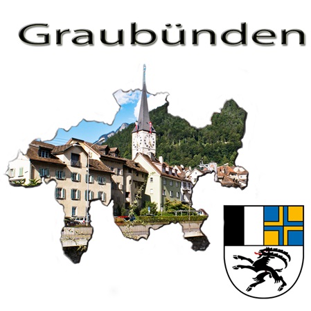
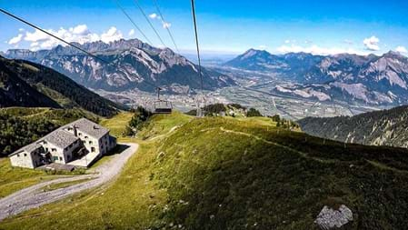
Ausflugsziele im Kanton Graubünden
Graubünden die Schweiz in der Schweiz
Graubünden mit 615 Seen, über 900 Berggipfel und 150 Täler bedeutet Natur pur. Der höchste Berg ist der Piz Bernina mit 4049 Meter über Meer und der tiefste Punkt ist die Kantonsgrenze zum Tessin mit 260 Metern.
Als einziger Kanton der Schweiz hat Graubünden drei Amtssprachen: Deutsch, Rätoromanisch und Italienisch. Aufgrund dieser und damit auch der kulturellen Vielfalt, aber auch wegen seiner Form und Beschaffenheit wird der Kanton auch als kleine Schweiz innerhalb der Schweiz bezeichnet.
in English back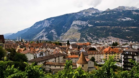
Churer Höhenweg
Maienfeld / Heididorf
Malans
Rofflaschlucht
Brambrüesch
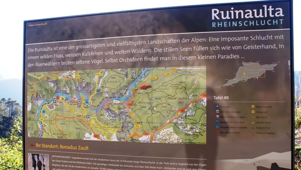
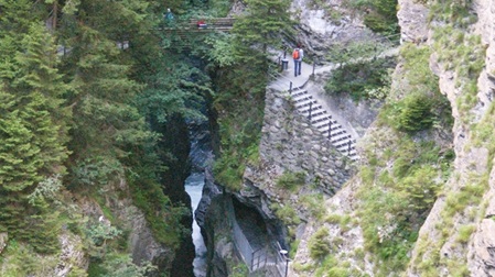
Ruinaulta – Rheinschlucht
Via Mala Schlucht
Flüelapass
Albulapass
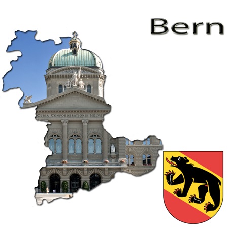
Ausflugsziele im Kanton Bern
Sechs grosse Regionen prägen den Kanton Bern:
- das Berner Oberland mit seiner imposanten Berg- und Seenlandschaft,
- das hügelige Emmental mit den stattlichen, blumengeschmückten Bauernhöfen,
- der Oberaargau mit seinen Feldern und Wäldern,
- die Region Bern-Mittelland mit dem UNESCO-Welterbe – der Altstadt von Bern,
- die Seen und Gemüsefelder des Seelands
- und der französischsprachige Berner Jura mit dem Regionalpark Chasseral.
Bekannte Tourismusdestinationen sind: Bern–UNESCO-Weltkulturerbe, Jungfrau-Aletsch/Bietschorn–UNESCO-Weltnaturerbe, Gstaad, Grindelwald, Interlaken, Adelboden.
in English back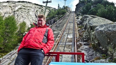
Gelmerbahn und -Stausee
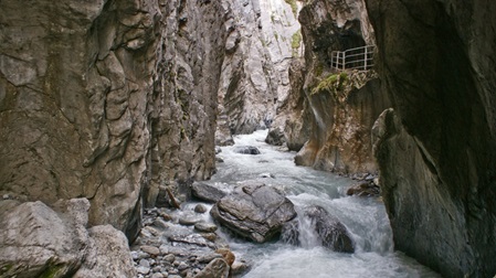
Gletscherschlucht Rosenlaui
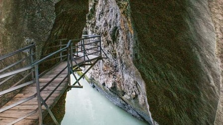
Aareschlucht
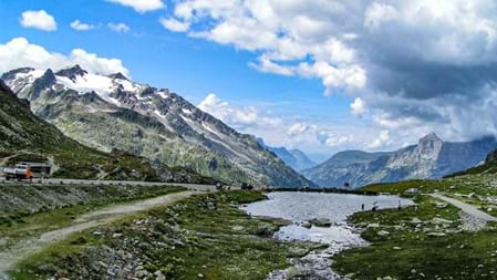
Sustenpass
Biel
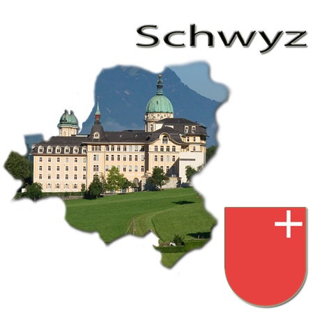
Ausflugsziele im Kanton Schwyz
Schwyz hinterlässt bleibende Eindrücke.
Der Kanton Schwyz liegt in der Zentralschweiz zwischen Zuger-, Vierwaldstätter- und Zürichsee und grenzt an die sieben Kantone Uri, Glarus, St. Gallen, Zürich, Zug, Luzern und Nidwalden. Er gehört grösstenteils zu den Schwyzer Voralpen, einem Teil der Zentralschweizer Voralpen.
Der Kanton Schwyz, geprägt von weiten Ebenen, steilen Bergwänden, wilden Flüssen und schönen Seen.
Landschaftlich Einmaliges wie:
- das Karstgebirge
- der alpine Urwald im Muotathal,
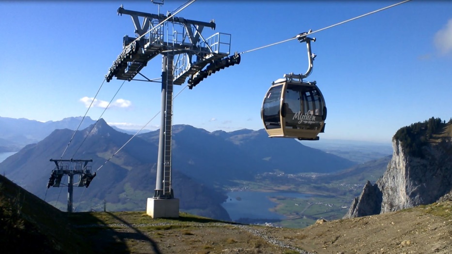
- der Rundblick von Mythen,
- die Rigi, Königin der Berge
- die herrliche Natur,
- die Berg- und Seenwelt,
laden dazu ein, diesen ursprünglichen Kanton zu besuchen.
Historische Stätten wie die Hohle Gasse, Morgarten, die Schwyzer Herrenhäuser oder die ältesten Holzhäuser der Schweiz warten auf ihre Entdeckung.
Dazu kommen gelebtes Brauchtum, altes Handwerk, weltbekannte Kulturstätten wie das Kloster Einsiedeln.
in English back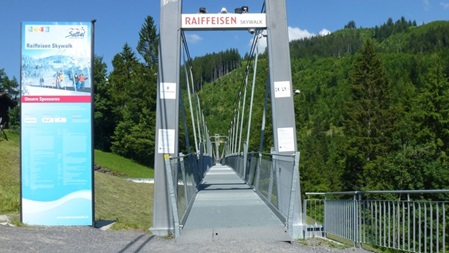
Sattel - Mostelberg
Raiffeisen SKYWALK
Die Rotenflue
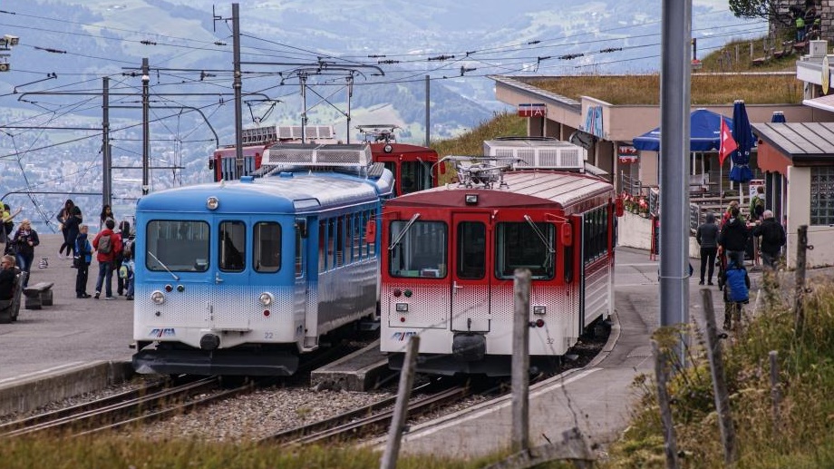
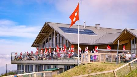
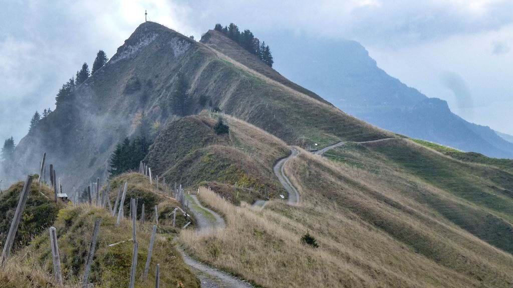
Rigi - Königin der Berge
Stoos - Fronalpstock
Höhenweg Hoch Ybrig
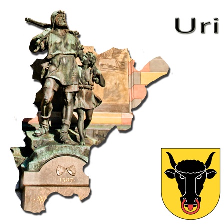
Ausflugsziele im Kanton Uri
Wo Wilhelm Tell und Rütlischwur den Ursprung haben
Der Kanton Uri liegt in der Zentralschweiz zwischen dem Vierwaldstättersee im Norden und dem Gotthardpass im Süden.
Aufgrund der Topographie mit einem Anteil an gebirgigen, unproduktiven Flächen von rund 56 Prozent wohnen drei Viertel der Einwohner im untersten Kantonsteil, in der Reussebene.
Uri grenzt an die Kantone Graubünden, Tessin, Wallis, Bern, Obwalden, Nidwalden, Schwyz und Glarus.
Da durch den Kanton Uri einer der wichtigsten Alpenübergänge führt, hat der Kanton seit Jahrhunderten ein hohes Verkehrsaufkommen zu bewältigen mit all seinen Vor- und Nachteilen.
Der Gotthardpass als kürzester Nord-Süd-Übergang der Alpen hat vor allem seit dem Ausbau der Schöllenenschlucht ab den Jahren um 1220 und dem Bau der ersten Teufelsbrücke im Jahr 1230 eine grosse Bedeutung für die Menschen beidseits des Alpenbogens.
1882 wurde der Gotthard-Eisenbahntunnel eröffnet. 1980 folgte der Gotthard-Strassentunnel. Im Dezember 2016 wurde der mit rund 57 Kilometern längste Eisenbahntunnel der Welt in Betrieb genommen.
in English back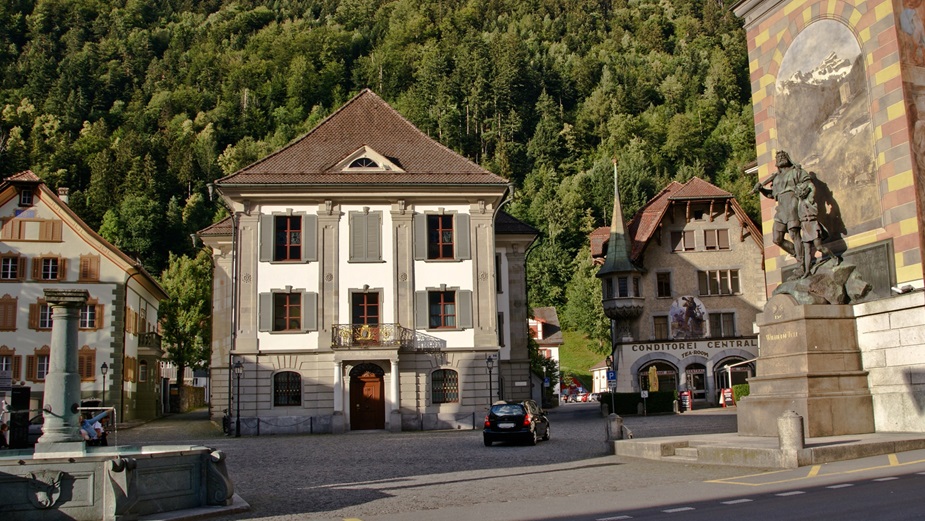
Altdorf
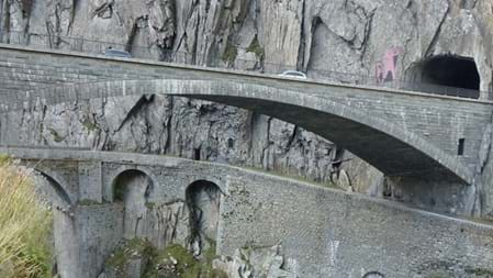
Schöllenenschlucht Teufelsbrücke
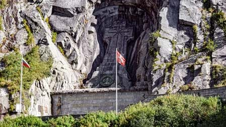
Schöllenenschlucht Suworow-Denkmal
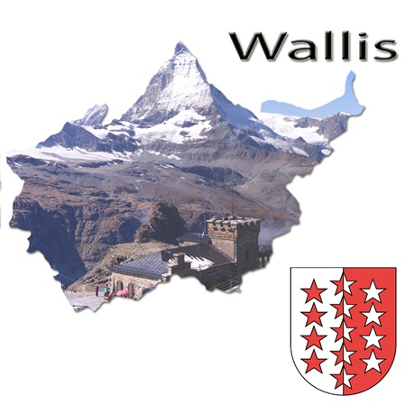
Ausflugsziele im Kanton Wallis
Wallis Kanton der Superlative: majestätische Viertausender, 300 Sonnentage pro Jahr, 3096 Kilometern Skipisten, über 8‘000 Kilometer beschilderten Wanderwege, herrliche Weine, wunderbares Obst und schmackhafte Gewürze.
Das Wallis besteht (mit Ausnahme kleinerer Gebiete jenseits der Pässe Simplon und Gemmi) aus dem Tal der Rhone (Rotten) vom Rhonegletscher bis zum Genfersee und den Rhone-Seitentälern.
Im Norden liegen die Berner und Waadtländer Alpen, im Süden die Walliser Alpen mit den mächtigsten und höchsten Bergmassiven der Alpen.
Mit dem Aletschgletscher, dem Gornergletscher und dem Walliser Fieschergletscher befinden sich im Wallis die drei grössten Gletscher der Alpen.
Durch den Schutz der umliegenden Berge ist das Haupttal des oberen Wallis, aber auch das Vispertal ausgesprochen trocken und warm mit einem Steppenklima.
Die Wasserversorgung wird vielerorts durch Wasserleitungen, sogenannte Suonen oder Bissen, gewährleistet, die in den niederschlagsarmen Zonen im Wallis mindestens bis in die römische Zeit zurückreichen.
in English back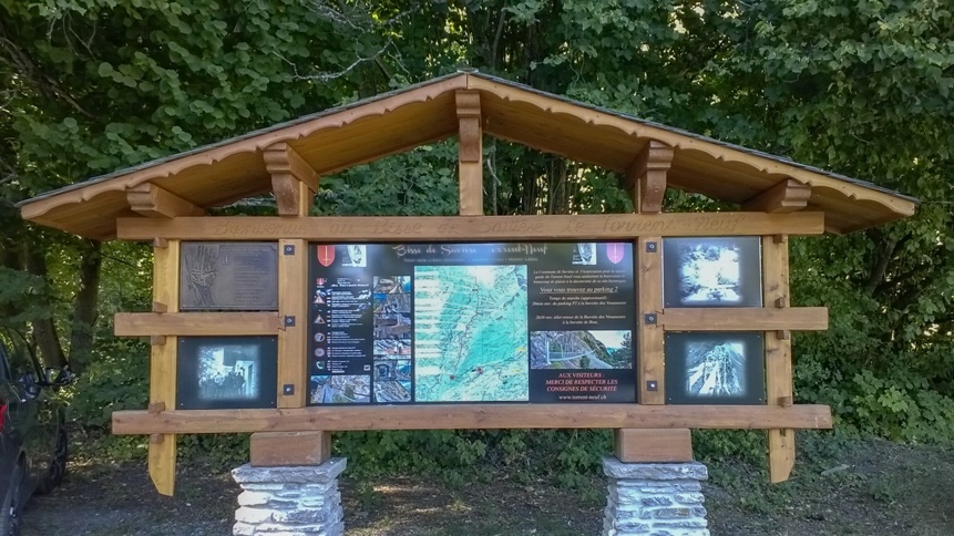
Bisse du Torrent-Neuf
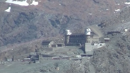
Gornergrat
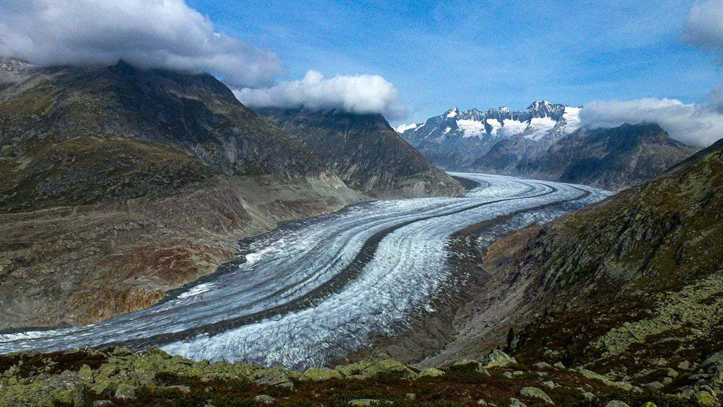
Aletsch Arena
Bettmerhorn
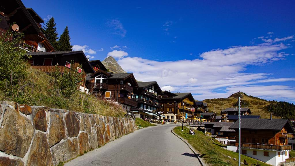
Bettmeralp
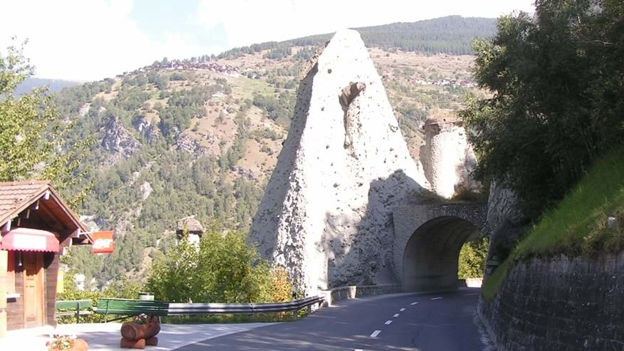
Erdpyramiden von Euseigne
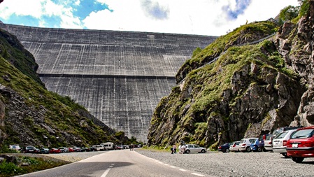
Grande Dixence
Sitten / Sion
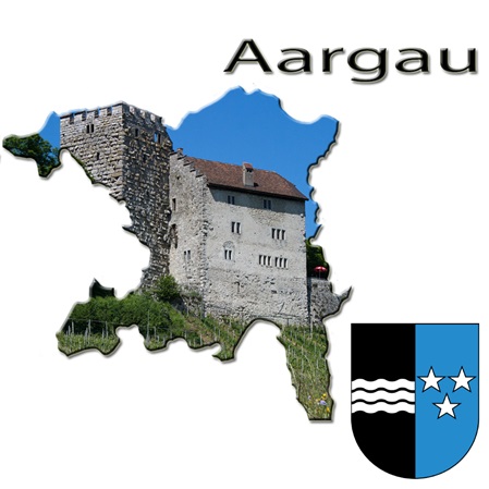
Ausflugsziele im Kanton Aargau
Der Aargau hat seinen Namen vom Fluss Aare.
Er grenzt im Norden an den Rhein und damit an Baden-Württemberg, im Osten an den Kanton Zürich, im Süden an die Kantone Luzern und Zug, und im Westen an die Kantone Bern, Solothurn und Basel-Landschaft.
Der Aargau weist eine starke naturräumliche Gliederung auf. Der nördliche Kantonsteil wurde durch die Gebirgsbildung des Juras geprägt, der im Mittelland gelegene südliche Teil durch die Gletscherbewegungen der Eiszeiten geformt.
Entgegen dem Bild eines Industrie-, Autobahn- und Kernkraftwerk-Kantons gibt es auch einige touristische Sehenswürdigkeiten.
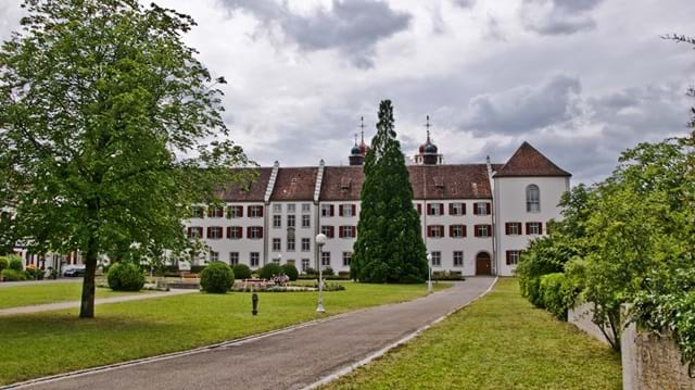
Zahlreiche Burgen und Schlösser können besichtigt werden, wie zum Beispiel Schloss Lenzburg, Schloss Hallwyl, Schloss Wildegg oder die Habsburg. Ein weiterer Anziehungspunkt ist das Kloster Muri.
Ein beliebtes Ziel für Tagesausflüge ist der Hallwilersee. Es besteht im ganzen Kanton ein grosses Angebot an gut beschilderten Wander- und Fahrradwegen.
Im Kanton gibt es zahlreiche Thermalquellen, die in Bad Zurzach, Rheinfelden AG, und Schinznach-Bad für öffentliche Thermalbäder genutzt werden.
in English back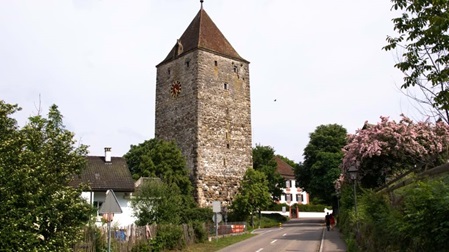
Kaiserstuhl
Bremgarten
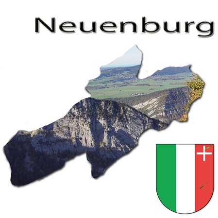
Ausflugsziele im Kanton Neuenburg
Der Kanton liegt in der geographischen Region des Schweizer Juras in der französischsprachigen Westschweiz. Entlang des Neuenburgersees zieht sich ein flacher Uferstreifen, le Littoral genannt. Die gleichnamige Hauptstadt Neuenburg liegt am Seeufer. Nördlich davon, begrenzt durch den Chaumont, liegt das Val de Ruz.
Westlich von Neuenburg, noch in der Seeuferebene, befindet sich der Schwemmlandkegel an der Mündung der Areuse. Das Tal verengt sich weiter westlich zu einer schmalen Schlucht und öffnet sich dann zum Hochtal Val de Travers. Zwischen dem Val de Travers und dem Neuenburgersee befindet sich die Kette des Chasseron, die aber zum grössten Teil auf dem Gebiet des Kantons Waadt liegt. Der markante Felskessel des Creux du Van bildet das östliche Ende dieser Bergkette.
Nördlich des Val de Travers und des Val de Ruz zieht sich über die gesamte Länge des Kantons eine Bergkette, die ganz im Osten mit dem Chasseral ihren höchsten Punkt erreicht. Der wichtigste Passübergang ist die Vue des Alpes. Dahinter befinden sich das Vallée des Ponts und das Hochtal von La Chaux-de-Fonds. Die Schlucht des Doubs mit dem Lac des Brenets bildet einen Teil der Grenze zu Frankreich.
in English back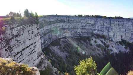
Creux du Van
Ausflugsziele im Kanton Obwalden
Der Kanton Obwalden liegt in der Zentralschweiz; da Unterwalden zu einem der drei Gründungskantone der Eidgenossenschaft zählt, ist auch von der Urschweiz die Rede.
Der Kanton Obwalden umfasst in etwa das Einzugsgebiet der Sarner Aa bis zu deren Mündung in den Alpnachersee, dieser ist nur durch eine Engstelle vom südwestlichen Ausläufer des Vierwaldstättersees getrennt. Im Norden verläuft die Grenze zum Kanton Luzern auf den Kämmen der Emmentaler Alpen, dahinter liegt das Entlebuch. Im Süden bildet das Tal des Brünigpasses die Grenze zum Kanton Bern. Im Osten grenzt Obwalden an den anderen Halbkanton Nidwalden, die Gemeinde Engelberg ist vom übrigen Kantonsgebiet durch Nidwaldner Gebiet abgetrennt und bildet eine Exklave, eingeklemmt zwischen Gebiet von Nidwalden und Uri.
Der Kanton Obwalden ist geprägt von den Gegensätzen zwischen Bergland, den "Unterwaldner" Voralpen, und der Ebene der Sarner Aa mit gleich mehreren Seen.
in English back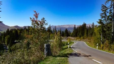
Glaubenbielenpass
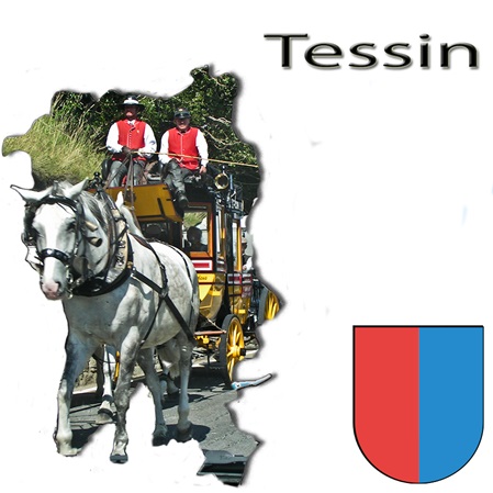
Ausflugsziele im Kanton Tessin
Das Tessin ist ein Kanton im südlichen Teil der Schweiz. Der Hauptort ist Bellinzona, die bevölkerungsreichste Stadt Lugano. Der südliche Teil des Kantons zählt zur grenzüberschreitenden schweizerisch-italienischen Metropolregion Tessin.
Im Tessin wird Italienisch und Lombardisch gesprochen; in der Gemeinde Bosco/Gurin ist Walserdeutsch die altherkommene Sprache. Höchste Erhebung ist mit 3402 m ü. M. das Rheinwaldhorn, der tiefste Punkt liegt mit 193 m ü. M. am Lago Maggiore und ist zugleich der tiefste Punkt der Schweiz.
Zusammen mit den vier Bündner Südtälern Bergell (Val Bregaglia), Calanca-Tal (Val Calanca), Misox (Val Mesolcina) und Puschlav (Val Poschiavo) bildet es die italienischsprachige Schweiz. Es liegt auf der Alpensüdseite und ist weitgehend von Italien umgeben; im Norden und Nordosten grenzt es an die Schweizer Kantone Graubünden, Wallis und Uri. Etwa ein Viertel des Gebiets gilt als unproduktiv, und ein Drittel ist bewaldet. Wichtige Akzente setzen die beiden grossen Seen Lago Maggiore und Lago di Lugano.
in English back
Auf der Tremola über den Gotthard-Pass
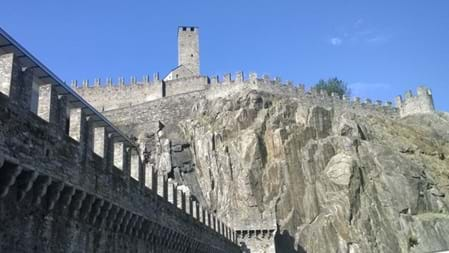
Bellizona
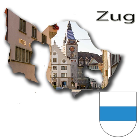
Ausflugsziele im Kanton Zug
Der Kanton Zug liegt mitten in Europa und im Herzen der Schweiz. Er gilt als Scharnier zwischen dem urbanen Kanton Zürich und den ländlichen Kantonen der Zentralschweiz.
Landschaftlich ist der Kanton Zug geprägt von zwei malerischen Seen, von sanften Hügeln und von reizvollen Voralpen. Dank einer ausgezeichneten Infrastruktur für den öffentlichen und privaten Verkehr sind die Zentren Zürich und Luzern in weniger als dreissig Minuten erreichbar.
Die an der Schwyzer Grenze gelegenen höheren Berge, wie Rossberg (1582 m ü. M.), Chaiserstock (1426 m ü. M.), Morgartenberg (1244 m ü. M.) und Höhrohnen (1229 m ü. M.), werden in Richtung Nordwesten durch Vorberge abgelöst. Zu den Vorbergen gehören unter anderem der Zugerberg (991 m ü. M.) und Gubel (909 m ü. M.).
in English back
Zug Teil 1
Zugerberg